
Architect Courmayeur: this page collects the public data available for owners and foreign buyers considering a villa project in Courmayeur (AO): OMI villa values, the area, planning rules and landscape constraints, and the checks to make before buying a plot. Every figure is sourced; the studio’s assessments are labelled as such and where a figure is not available we say so. Federico Cappellina Architects is based in Verona.
Studio projects
Some projects by the studio: each card leads to the project page, with photos and description. The full list is on the Projects page.
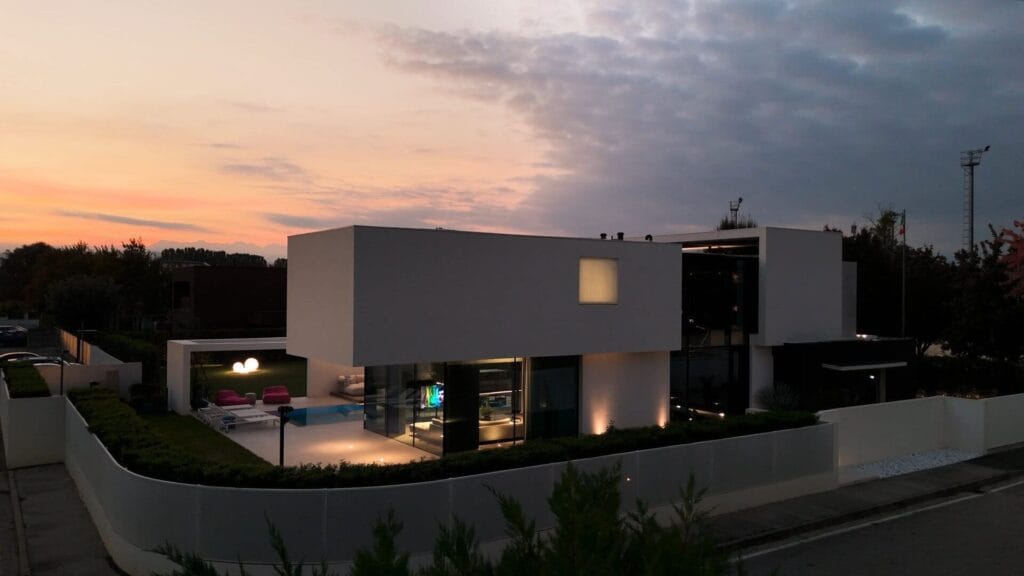
AV Home — Dueville (Vicenza)
Contemporary villa of about 300 m² in Dueville (Vicenza), with an infinity pool, interiors and a private spa. See the project →
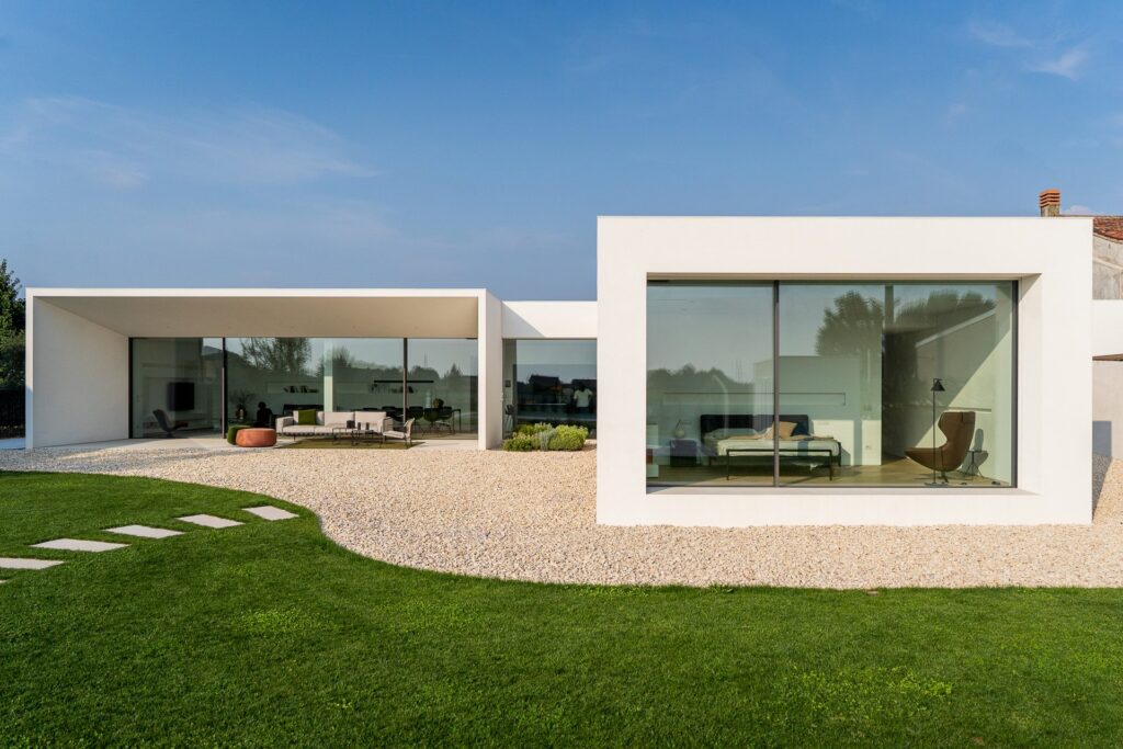
Villa MD Home — Verona
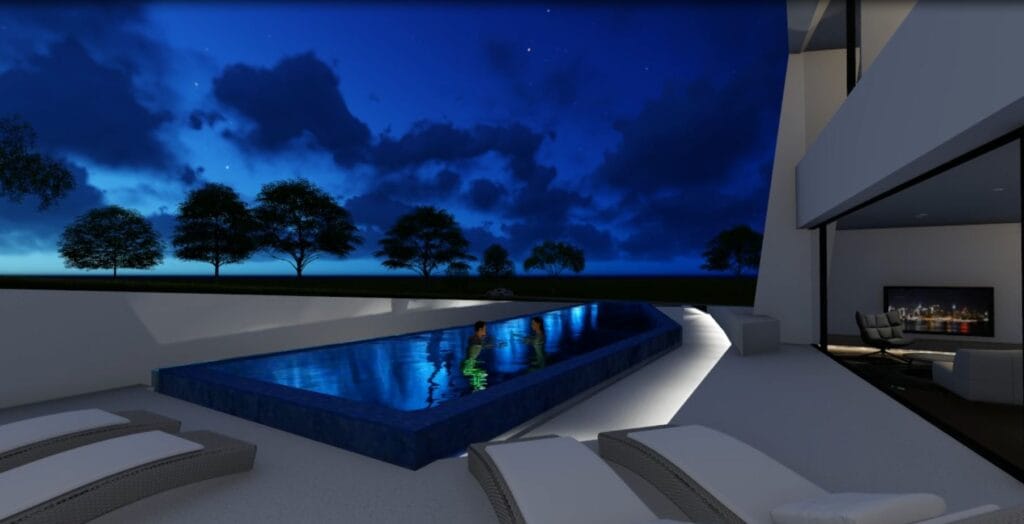
Villa in Verona, 280 m²: white volumes, a black wall, floor-to-ceiling glazing and a pool. See the project →

All studio projects
Villas, interiors and multi-residential projects by the studio: the full list is on the Projects page. See all projects →
Talk to the studio: architect Courmayeur
For information on a plot, a property or a villa project: write to the studio, the answer comes in writing.
or write to info@federicocappellina.com
Architect Courmayeur: villa market in Courmayeur: OMI data
The reference for residential values is the OMI database (Osservatorio del Mercato Immobiliare) published by the Agenzia delle Entrate, the Italian revenue agency. The figures below refer to the second semester of 2025, as reported via recasa.re.
- Ville e villini (detached and semi-detached houses), medium bracket: 6,350 €/sqm, with a zone maximum of 7,500 €/sqm.
- All residential properties, average: 4,091 €/sqm.
- NTN 2024 (numero di transazioni normalizzate — normalised number of residential sales): 136.8 residential transactions, of which 14 concerned properties over 145 sqm.
The gap between the average figure and the villa bracket is significant, and the number of transactions above 145 sqm is small. For a project, this is a valuation by the studio: the segment of larger houses is thin, so the price of a single property depends heavily on position, exposure, condition and the constraints that apply to it, more than on a general market trend. The OMI brackets are a statistical reference, not an appraisal; a specific valuation requires a survey of the individual property.
To be verified: the OMI figures are published by zone and by property type, and the micro-zone applicable to a given address must be checked against the full OMI table for the municipality.
Architect Courmayeur: the area of Courmayeur
Courmayeur is located in the Valle d’Aosta, in the upper Valdigne, at the foot of Monte Bianco (it.wikipedia.org). The built-up centre stands at 1,224 m above sea level (wikidata.org). The resident population is reported as 2,521 inhabitants at 1 January 2025, a figure attributed to ISTAT by a secondary source; a direct ISTAT table confirming it is not available here (comuniditalia.it).
The Italian municipalities bordering Courmayeur are indicated as La Salle, La Thuile, Morgex, Pré-Saint-Didier and Saint-Rhémy-en-Bosses. The territory also borders French and Swiss municipalities, but the complete list cannot be confirmed here with an institutional source among those available (italiamappata.it; it.wikipedia.org). Road distances from main provincial capitals or airports are not stated: the available sources do not report verifiable road distances, and these must be checked directly.
On the physical setting, the sources available do not identify a lake or a sea as a relevant local geographic reference; the context is Alpine. The seismic classification is zone 3, according to the figure reported on a secondary source’s municipal page, which attributes the classification to the Protezione civile (Civil Protection); an official sheet specific to Courmayeur is not available here (comuniditalia.it; Protezione civile). The climatic classification is zone F, with 3,926 degree-days (comuniditalia.it).
Three Natura 2000 sites fall within the municipal territory: the Special Area of Conservation (ZSC) “Ambienti glaciali del Monte Bianco” (IT1204010), the Special Protection Area (ZPS) “Val Ferret” (IT1204030) and the ZSC “Talweg della Val Ferret” (IT1204032) (Regione Valle d’Aosta). Further municipal protected areas cannot be indicated with the sources available.
For a project, this is a valuation by the studio: altitude, climatic zone F and the presence of Natura 2000 sites are factors that affect envelope performance, heating demand and the environmental screening of any intervention. The seismic classification in zone 3 is a design parameter to be confirmed with the municipality before structural assumptions are made.
Architect Courmayeur: planning and landscape constraints in Courmayeur
The general planning instrument is the Piano regolatore generale comunale (PRG) — the municipal general master plan — not a PAT/PI or a PGT as in other Italian regions. The substantial general variant was definitively approved by municipal council resolution no. 8 of 22 February 2013; the original PRG dates from 1989 and has been amended by subsequent variants. The regional page lists the details of the amendments and links to the documentation: PRG page for Courmayeur; approval resolution; regional sheet confirming the 2013 approval.
On landscape constraints, the regional documentation confirms for properties located in the municipality the presence of the constraint “Bellezze naturali – PTP – Vincolo D.Lgs. 42/2004” (landscape protection under Legislative Decree 42/2004), but that sheet does not identify the municipal extent of the individual categories under articles 136 and 142: regional sheet.
- Art. 142, letter g — woods: woods are protected as landscape under art. 142, paragraph 1, letter g; the cartographic check is indicated through Tavola P2 of the regional landscape plan on the geoportal: regional reference on woods and cartographic consultation. Which wooded areas of the municipality fall under the constraint cannot be stated from the available sources.
- Art. 142, letter d — mountains above the statutory elevations: the perimeters applicable to Courmayeur cannot be confirmed here with a specific cartographic source.
- Art. 142, letters b and c — lake belts and watercourses: which belts and water bodies in the municipal territory are constrained cannot be confirmed with a specific cartographic source. The regional sheet mentions land at risk of flooding and lakes as non-buildable areas, but this alone is not sufficient to identify the landscape constraint under art. 142: regional sheet.
- Art. 142, letter a — coastal belts: a municipal constraint of this category cannot be attested; the available sources do not provide a specific cartographic check.
- Art. 136 — areas of notable public interest: the regional sheet confirms the presence of a constraint for “bellezze naturali”, but does not specify the decrees or perimeters referable to art. 136. Which municipal areas are affected cannot be stated: regional sheet.
On limits to new construction, the regional documentation confirms non-buildable areas for avalanches and landslides, flooding, wetlands and lakes, as well as wooded areas; it also states that uses and prescriptions depend on the PRG zone and its technical rules. A general prohibition on new construction valid for the whole municipality cannot be summarised here: the individual parcel must be checked against the PRG maps and the maps of non-buildable areas, and the relevant rules applied. Sources: PRG page and variants; regional sheet with references to non-buildable areas and PRG rules.
For a project, this is a valuation by the studio: the combination of a PRG dating from 1989 with a 2013 general variant, and of landscape constraints whose perimeters are not fully mapped in the available sources, means that the feasibility of any intervention must be established parcel by parcel before design work begins. The verification to be done is a formal check with the municipality on the PRG zone, the non-buildable area maps and the landscape constraint perimeters applicable to the specific property.
Architect Courmayeur: what this means for designing a villa in Courmayeur
The facts above have direct consequences for a project. The following are the studio’s assessments, not regulatory statements; each one is tied to a verified fact and followed by the check it requires.
- Altitude and climate (fact: centre at 1,224 m; climate zone F, 3,926 degree-days — wikidata.org, comuniditalia.it). Assessment of the studio: zone F is the coldest bracket in the Italian classification, and the number of degree-days governs heating demand and the sizing of the building envelope. A villa here should be designed around thermal performance from the outset — insulation, glazing, thermal bridges, snow loads on roofs — rather than corrected afterwards. Verification: the structural and energy requirements applicable to the specific plot must be confirmed with the municipality and with a structural engineer.
- Seismic classification (fact: zone 3, per a secondary source citing the Protezione civile — comuniditalia.it, protezionecivile.gov.it). Assessment of the studio: seismic design enters the structural calculation and the cost estimate from the first sketch. Verification: the official classification for Courmayeur must be confirmed on the regional or national seismic portal before the structural brief is fixed.
- Landscape constraints (fact: the regional documentation attests the presence of the «Bellezze naturali – PTP – Vincolo D.Lgs. 42/2004» constraint for properties in the municipality — regione.vda.it). Assessment of the studio: where a landscape constraint applies, the design is not only a matter of PRG parameters; materials, volumes, colours and the treatment of outdoor areas become part of an authorisation process. Verification: the exact perimeter affecting the plot must be read on the regional landscape plan cartography (Tavola P2) and confirmed with the municipality.
- Undevelopable areas (fact: the regional documentation attests undevelopable areas for avalanches, landslides, flooding, wetlands and lakes, and wooded areas — regione.vda.it). Assessment of the studio: on a mountain site, the feasibility of a villa is decided first by these maps, then by the building rules. A plot that looks buildable on the ground may fall within an undevelopable ambit. Verification: the parcel must be checked against the PRG tables and the hazard cartographies before any design work begins.
- Natura 2000 sites (fact: ZSC «Ambienti glaciali del Monte Bianco» IT1204010, ZPS «Val Ferret» IT1204030, ZSC «Talweg della Val Ferret» IT1204032 — regione.vda.it). Assessment of the studio: a plot inside or near these sites brings an additional level of assessment into the process. Verification: the distance of the parcel from each site boundary must be checked on the regional cartography.
- Planning instrument (fact: the general plan is the PRG, with the substantive general variant approved by council resolution no. 8 of 22 February 2013; the original PRG dates from 1989 — regional PRG page, approval resolution). Assessment of the studio: Courmayeur does not use a PAT/PI or PGT; the applicable rules are those of the PRG and its technical norms, zone by zone. Verification: the zone of the parcel and its prescriptions must be read on the current PRG tables.
Architect Courmayeur: checks before buying a plot in Courmayeur
The following sequence is specific to this municipality. Each step produces a document that should be obtained before signing.
- PRG zone and technical norms. Identify the parcel on the current PRG tables and read the prescriptions for its zone. Start from the regional PRG page for Courmayeur and the 2013 approval resolution.
- Undevelopable ambits. Check the parcel against the hazard maps for avalanches, landslides and flooding, and against wetlands, lakes and wooded areas, as referenced in the regional sheet.
- Landscape constraint. Confirm whether the parcel falls within the «Bellezze naturali – PTP – Vincolo D.Lgs. 42/2004» perimeter, and read the regional landscape plan cartography (Tavola P2) for wooded areas under art. 142, lett. g. The extent of the art. 136 and art. 142 categories at municipal level is not identified in the available sources and must be checked with the municipality.
- Natura 2000 proximity. Verify the distance from the three sites listed in the regional document.
- Seismic classification. Obtain the official classification for the municipality; the zone 3 figure comes from a secondary source and must be confirmed.
- Access and services. Road distances from capitals and airports are not stated in the available sources and must be checked directly; the same applies to the actual accessibility of the plot.
- Cadastral and title checks. A notary and a geometra should verify the cadastral identification, any discrepancies and the absence of encumbrances before the preliminary contract.
Architect Courmayeur: how the studio works
The studio follows a sequence of stages, adapted to the constraints found at each step.
- Brief and site reading. The client’s programme is set against the facts of the site: PRG zone, constraints, orientation, access.
- Feasibility check. The applicable rules and cartographies are verified before the design develops, so that the project is built on confirmed parameters.
- Concept design. Volumes, distribution and the relationship with the landscape are defined, taking the constraint framework into account.
- Technical development. Structural, energy and envelope decisions are coordinated with the relevant specialists.
- Authorisation process. The application is prepared and followed through the municipal and, where applicable, landscape-authority procedures.
- Construction phase. The studio follows the works through to completion.
The scope and duration of each stage depend on the municipality’s procedures and on the constraints affecting the plot; these are defined in the appointment.
Do you need an architect Courmayeur for your plot?
Before buying, the studio reads the planning instrument, constraints and indices of the plot with you. Send the location, cadastral references or the listing.
or write to info@federicocappellina.com
Architect Courmayeur: frequently asked questions
What should an architect Courmayeur know about the plot before designing?
An architect Courmayeur needs the planning designation, constraints, indices, access and services of the plot: this information comes from the municipality, the land registry and a survey, and it determines what can be built.
How to assess an architect Courmayeur for a new villa?
Compare several professionals, their completed projects and their terms of appointment. With an architect Courmayeur it is also useful to ask about experience with landscape permits and the municipal technical office.
Must an architect Courmayeur be registered?
Yes: to sign a building project in Italy the architect must be registered with the professional order, which can be checked on the website of the provincial order of architects.
How much does an architect Courmayeur cost for a villa?
An architect Courmayeur’s fee depends on the size of the work, the plot’s constraints and the stages requested (design, permit application, construction drawings, site supervision): it is set in a written quotation after the plot has been analysed.
What should you ask an architect Courmayeur to put in writing before the appointment?
The scope with the stages included, the fee for each, the estimated timing and the list of consultants involved. An architect Courmayeur should also state which checks remain with the client.
Can an architect Courmayeur handle the landscape permit too?
Yes: where the area is subject to a landscape constraint the architect prepares the documentation for the landscape authorisation together with the design; timing depends on the authorities concerned.
How long does an architect Courmayeur need to design a villa?
It depends on complexity and approval times: the design develops in stages and permit timing must be checked with the municipality before a schedule is fixed.
Can you involve an architect Courmayeur before buying the plot?
It is the prudent choice: the architect checks indices, constraints and access on the plot before the purchase, so conditions can be discussed with the seller while the decision is still open.
When should you involve an architect Courmayeur before buying a plot?
Before signing the preliminary contract. An architect Courmayeur reads the planning instrument, the constraints map and the technical rules that apply to the plot, and lists the checks to request from the municipality and the notary: this is the stage where a mistake costs least.
What does an architect Courmayeur do besides the design?
An architect Courmayeur follows the building and landscape permit, coordinates the consultants (structures, services, geologist) and supervises the works. The stages are described in the section «How the studio works».
How to choose an architect Courmayeur for a villa?
Look at completed projects, knowledge of local planning instruments and the ability to follow the site. The studio’s projects are on the Projects page.
Is Courmayeur in a seismic zone?
A secondary source reports zone 3, attributing the classification to the Protezione civile (comuniditalia.it, protezionecivile.gov.it). A specific official sheet for Courmayeur is not available here; the figure must be checked with the municipality.
Which planning instrument applies in Courmayeur?
The PRG (Piano regolatore generale), not a PAT/PI or PGT. The substantive general variant was approved with council resolution no. 8 of 22 February 2013; the original PRG dates from 1989 (regional PRG page).
Is there a general ban on new construction in the municipality?
The available sources do not allow such a general ban to be stated. Undevelopable ambits exist for avalanches, landslides, flooding, wetlands, lakes and wooded areas, and prescriptions depend on the PRG zone (regional sheet). The parcel must be checked individually.
Are there landscape constraints on properties in Courmayeur?
The regional documentation attests the «Bellezze naturali – PTP – Vincolo D.Lgs. 42/2004» constraint for properties in the municipality, but does not identify the municipal extent of the individual art. 136 and art. 142 categories (regional sheet). The perimeter affecting a specific plot must be checked with the municipality.
Are wooded areas subject to landscape protection?
Yes, under art. 142, comma 1, lett. g; the cartographic check is indicated through Tavola P2 of the regional landscape plan (reference on wooded areas and cartographic consultation). Which wooded surfaces in the municipality fall within the constraint is not stated in the available sources.
What are the reference property values?
OMI, second semester 2025: ville e villini medium 6,350 €/sqm (zone maximum 7,500); all residential average 4,091 €/sqm; 136.8 residential transactions in 2024, of which 14 above 145 sqm (recasa.re). These are statistical brackets, not an appraisal.
How cold is the climate for design purposes?
Climate zone F, 3,926 degree-days (comuniditalia.it). The studio treats this as a design driver for the building envelope and heating demand.
For a specific plot or property in Courmayeur, the studio can review the facts above against the parcel and set out which checks remain open. Contact the studio; selected work is published at federicocappellina.com/projects.
Architect Courmayeur: ask the studio for information
For a villa project or a plot consultation: tell us the municipality, the area and your starting ideas. Direct contact with the architect, in writing.
or write to info@federicocappellina.com